

Carrying out topographical surveys, earthwork volumetric calculations, and site inspections on modern civil engineering projects requires data that is both accurate and delivered rapidly. Across Middlesbrough, Teesside, and the broader North East, drone technology has transformed traditional land surveying by drastically reducing survey turnarounds, keeping personnel safe from hazardous ground conditions, and capturing spatial data with millimeter-level precision.
However, when commissioning an aerial survey, project managers, site engineers, and commercial leads face a crucial technical decision: Should you use drone LiDAR or drone Photogrammetry?
While both methodologies generate rich 3D data, high-density point clouds, and orthomosaic maps, they capture information in fundamentally different ways. Selecting the wrong aerial mapping technology can result in inaccurate elevation models, missed project deadlines, or inflated project costs.
In this guide, we unpack the physics, practical applications, financial considerations, and site-specific variables of LiDAR and Photogrammetry to help you choose the right mapping tool for your next North East construction or infrastructure project.
Understanding the Core Technologies
To evaluate which technology suits your site, you must first understand how each sensor acquires spatial data from above.
What is Drone Photogrammetry?
Photogrammetry is an optical surveying technique that calculates 3D coordinates using overlapping high-resolution 2D photographs.
A drone equipped with a high-megapixel imagery payload flies an automated grid over the target site. The drone captures overlapping imagery (usually with an 80% front lap and 70% side lap) from multiple angles.
Specialized photogrammetry software then identifies matching features across these overlapping photos using a process called Structure from Motion (SfM). By triangulating the location of these visual keypoints alongside precise location data provided by Ground Control Points (GCPs) or Real-Time Kinematic (RTK) positioning, the software reconstructs the terrain as a dense point cloud, 3D mesh, or high-resolution orthomosaic map.
- Primary Output: Photorealistic 2D orthomosaic maps, textured 3D models, digital surface models (DSMs).
- Core Sensor Type: High-resolution RGB optical cameras.
- Mechanism: Passive sensing (relies entirely on ambient light and visible surfaces).
What is Drone LiDAR?
LiDAR stands for Light Detection and Ranging. Unlike photogrammetry, LiDAR is an active remote sensing technology that emits its own light source to measure distances.
A drone-mounted LiDAR system houses a laser scanner, an Inertial Measurement Unit (IMU), and a high-precision GNSS receiver. The scanner fires hundreds of thousands (sometimes up to one million) laser pulses per second toward the ground. These light pulses strike objects on the earth’s surface and reflect back to the sensor.
By calculating the exact time it takes for each light pulse to travel to the target and return (known as Time-of-Flight), the system computes precise $X, Y, \text{and } Z$ spatial coordinates for every single return point. Furthermore, a single LiDAR beam can pass through gaps in tree leaves or structural grates, emitting multiple returns (for example, a 1st return off the top of a tree canopy, a 2nd return off an underlying bush, and a 3rd return off the bare earth below).
- Primary Output: Ultra-dense 3D point clouds categorized by return layers, digital elevation models (DEMs), bare-earth digital terrain models (DTMs).
- Core Sensor Type: Active laser scanner paired with a high-grade IMU.
- Mechanism: Active sensing (emits its own energy; independent of ambient lighting).
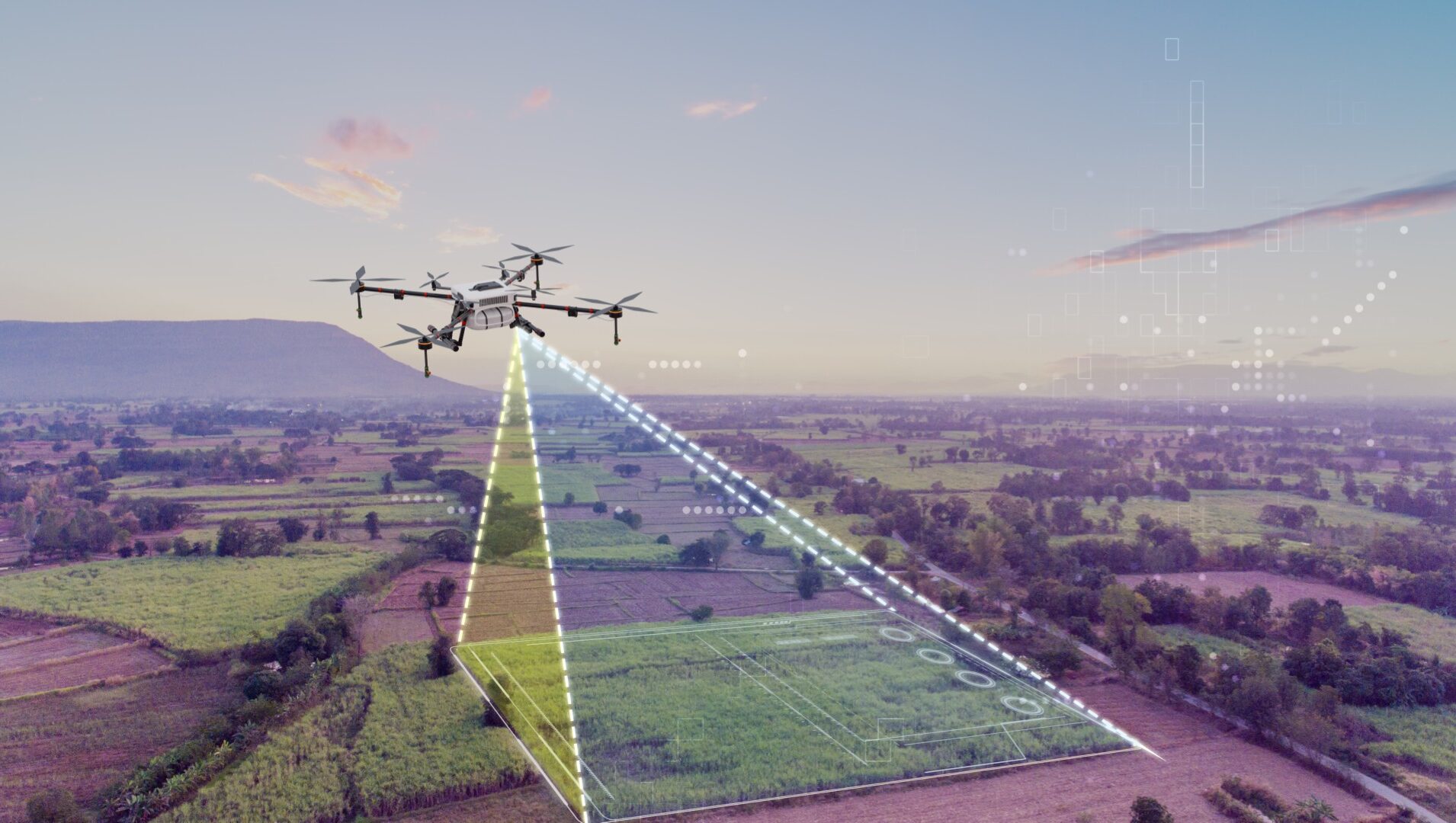
Technical Comparison
To help you assess the technical parameters side by side, the breakdown below highlights how LiDAR and Photogrammetry perform across critical operational metrics:
Data Acquisition Method
- Photogrammetry: Passive (Captures ambient visible light via overlapping photos)
- LiDAR: Active (Emits pulsed laser beams and measures time-of-flight)
Vegetation Penetration
- Photogrammetry: Poor. Cannot see through leaf canopy; measures top of vegetation layer.
- LiDAR: Exceptional. Multiple returns penetrate dense canopy to strike bare earth.
Vertical Accuracy ($Z$)
- Photogrammetry: High on clear, hard surfaces ($15\text{ to }30\text{ mm}$ with GCPs/RTK).
- LiDAR: Superior across complex terrain and ground surfaces ($10\text{ to }20\text{ mm}$).
Data Capture Speed
- Photogrammetry: Rapid flight times; slower processing due to heavy image matching algorithms.
- LiDAR: Fast flight acquisition; near-instant point cloud generation post-flight.
Visual / Contextual Quality
- Photogrammetry: Superior. Provides true-color, photorealistic aerial mapping and visual context.
- LiDAR: Mathematical point cloud; requires an auxiliary RGB camera for colorization.
Performance in Shadows / Low Light
- Photogrammetry: Limited. Requires bright, uniform ambient daylight without harsh shadows.
- LiDAR: Unaffected. Performs perfectly in low light, direct shadow, or total darkness.
Thin/Complex Structures
- Photogrammetry: Struggles to model thin wires, transmission lines, or vertical steel beams.
- LiDAR: Accurately strikes and maps narrow pipelines, cables, and structural framing.
Site Conditions: Deciding Between LiDAR and Photogrammetry
Knowing the theoretical differences is useful, but civil engineering projects are governed by real-world terrain, environmental restrictions, and structural complexities. Let’s evaluate how these technologies handle common site conditions found across the North East.
1. Heavily Vegetated Terrain and Greenfield Sites
If your project involves a greenfield site, woodland corridor, or overgrown brownfield plot prior to ground clearing, LiDAR is the clear winner.
Photogrammetry relies purely on what an optical camera lens can see from above. If a site is covered in thick bracken, dense tall grass, or heavy tree cover, an optical camera takes photos of the top layer of leaves. Consequently, the resulting elevation model reflects the height of the tree canopy instead of the underlying ground level. This creates massive structural errors when calculating cut-and-fill volumes or establishing true base elevations.
LiDAR’s multi-return capability solves this fundamental issue. While the first return strikes the top leaves of a tree canopy, subsequent returns pass through small gaps in the foliage, bouncing off branches, undergrowth, and ultimately the bare earth. By filtering out the upper returns in post-processing, geomatics engineers can generate an exceptionally accurate Bare-Earth Digital Terrain Model (DTM), giving civil engineers the exact ground topography required before breaking ground.
2. Open Terrains, Stockpiles, and Quarry Earthworks
For wide-open civil construction sites, aggregate quarries, highways, or stripped earthworks where ground surface visibility is completely unobscured, Photogrammetry provides an ideal, highly cost-effective solution.
When there is no vegetation obstructing the ground, photogrammetry delivers precise vertical and horizontal accuracy at a fraction of the hardware operational cost. Furthermore, photogrammetry provides a true-color, high-resolution orthomosaic background layer. This visual context allows site managers to visually inspect earthworks, trace site boundaries, track equipment placements, and calculate volumetric changes on aggregate stockpiles simultaneously.
3. Linear Infrastructure, Rail Corridors, and Power Lines
For linear civil assets (such as rail infrastructure, overhead utility corridors, and industrial pipe racks) LiDAR is overwhelmingly superior.
Linear infrastructure assets often feature fine, narrow structural elements like overhead catenary wires, narrow utility cables, signal gantries, and vertical structural columns. Photogrammetry struggles to map thin objects because matching algorithms fail to triangulate features that lack sufficient surface pixel area across multiple photos, often resulting in distorted or completely missing structures.
LiDAR laser pulses directly strike thin cables, lattice towers, and vertical steel structures, returning discrete point coordinates. This makes LiDAR the standard choice for corridor mapping, vegetation encroachment surveys along rail tracks, and sagging analysis on power lines.
4. Low-Light Operations and Narrow Urban Canyons
Weather conditions in the North East can present severe lighting challenges, especially during winter months when daylight windows are brief, sun angles are low, and deep shadows cast across steep excavation cuts or industrial sites.
- Photogrammetry deteriorates in poor light. Low ambient light creates motion blur or noisy image files, while long shadows confuse matching algorithms, leading to spatial distortions in the 3D model.
- LiDAR emits its own light source (near-infrared lasers). It operates completely independent of ambient lighting conditions. Whether flying at twilight, under dense cloud cover, or in shaded industrial yards, LiDAR captures consistent spatial measurements without quality loss.
The Role of Accuracy: GCPs, RTK, and Absolute Precision
A common misconception in drone surveying is that higher point density automatically equals higher accuracy. In civil engineering, precision is categorized into two distinct metrics: Relative Accuracy and Absolute Accuracy.
- Relative Accuracy: The degree to which a point on a location map is accurate relative to other points within the same map (for example, whether the distance between two kerbs on the 3D model is measured accurately as exactly $5.00\text{ m}$).
- Absolute Accuracy: The degree to which a point on a map matches its true coordinate location on the earth’s surface using a recognized spatial reference system, such as the Ordnance Survey National Grid (OSGB36).
Both drone photogrammetry and drone LiDAR can achieve sub-centimeter relative accuracy and $15\text{ to }30\text{ mm}$ absolute accuracy, provided rigorous geodetic controls are established on site.
To achieve enterprise-grade accuracy, drone operations must utilize either Real-Time Kinematic (RTK) or Post-Processed Kinematic (PPK) satellite positioning systems. These systems stream real-time corrections to the drone flight control unit during flight, positioning the sensor within millimeters in 3D space.
Additionally, survey teams must lay out physical Ground Control Points (GCPs) across the site. Verified using high-precision GNSS rover base stations, GCPs are hard targets used to calibrate photogrammetry imagery and independently validate LiDAR point cloud accuracy against known benchmark elevations. Without strict survey control and experienced geomatics personnel, even high-end hardware will produce inaccurate spatial data that fails civil engineering compliance standards.
Real-World Applications Across North East Civil Engineering Sectors
To see how these principles apply practically, consider these common operational scenarios across North East key industries:
1. Major Highway Construction & Earthworks (such as A1 and A66 Upgrades)
- Recommended Technology: Combined Photogrammetry & LiDAR Hybrid Workflow.
- Application: Large-scale road corridor development requires both bare-earth DTMs across surrounding rural ground (captured via LiDAR) and high-resolution, photorealistic visual records for stakeholder reporting, access route planning, and site safety inductions (captured via Photogrammetry).
2. Brownfield Industrial Redevelopment (such as Teesside Freeport Sites)
- Recommended Technology: Drone LiDAR.
- Application: Legacy industrial sites across Middlesbrough and Teesside often feature overgrown vegetation alongside complex pipe racks, legacy concrete foundations, and disused steel framing. LiDAR penetrates ground cover while cleanly capturing industrial structures, allowing engineers to design demolition and remediation plans with pinpoint confidence.
3. Coastal Protection & Environmental Monitoring
- Recommended Technology: Drone Photogrammetry.
- Application: Monitoring cliff erosion, beach profile shifts, and sea wall stability requires high-detail visual texture to identify micro-fractures in concrete or rock structures. Photogrammetry captures high-resolution imagery capable of rendering sub-centimeter visual details alongside structural 3D models.
Cost-Benefit Analysis: Matching Budget to Project Scope
When procuring aerial survey services, cost is always a critical consideration. Understanding the cost drivers of both technologies ensures you don’t overspend on unnecessary hardware or underspend on a survey that fails to deliver usable data.
Cost Drivers of Photogrammetry
- Hardware Capital: Lower hardware costs allow service providers to offer highly competitive day rates for standard site mapping.
- Processing Time: High-resolution photogrammetry requires significant computing power to run Structure-from-Motion algorithms, resulting in longer post-processing windows for exceptionally large sites.
- Best Value For: Open ground surveys, progress tracking, visual site monitoring, volumetric calculations on clear terrain, and budget-sensitive baseline mapping.
Cost Drivers of LiDAR
- Hardware Capital: Enterprise-grade LiDAR sensors (incorporating calibrated laser heads and aviation-spec IMUs) require substantial capital investment.
- Processing Time: While point cloud generation is rapid, handling massive LiDAR datasets and manually classifying return ground layers requires specialist geomatics expertise.
- Best Value For: Dense vegetation clearing surveys, complex structural mapping, high-density asset corridor surveys, and high-risk environments where getting data right the first time is mission-critical.
Which Technology Should You Choose?
Select Drone Photogrammetry if your project requires:
- High-resolution photorealistic 2D orthomosaic maps for site context, planning, and progress reporting.
- Earthwork volumetric calculations on clear, unobscured ground surfaces (quarries, bare site cuts, open stockpiles).
- Detailed visual inspection of building facades, roofs, or structural surfaces.
- A cost-effective aerial surveying solution for open terrain development.
Select Drone LiDAR if your project requires:
- Accurate ground terrain models (bare-earth DTMs) beneath dense tree canopies, tall grass, or thick vegetation.
- Precise 3D modeling of thin, complex structures such as power lines, rail catenary systems, lattice towers, or pipe racks.
- Rapid surveying during low-light conditions, deep shadow environments, or short winter daylight windows.
- Penetration through structural open grates, mesh, or complex industrial infrastructure layouts.
Delivering Precision Drone Solutions Across the North East
Modern civil engineering and construction projects demand zero compromise when it comes to spatial data integrity, regulatory compliance, and site safety standards.
At Bottomley Drone Solutions, we bring decades of civil engineering heritage to our aerial operations. As part of the wider Bottomley Group, our drone operations are structured around the rigorous technical standards, safety protocols, and operational workflows expected on active tier-one construction, rail, and infrastructure sites across Middlesbrough and the wider North East region.
Whether your project calls for high-density drone LiDAR point clouds, sub-centimeter photogrammetric topographical surveys, or routine aerial progress mapping, our team operates CAA-compliant enterprise fleet technology tailored to your exact site requirements.
Ready to Plan Your Next Aerial Survey?
Contact our geomatics and aerial surveying specialists today to discuss your site conditions, review compliance requirements, or request a detailed project quote.